9559179325
 9559179325
 Login
Login

Hydrogeological Survey Report comprehensively plays a crucial role in determining the standardization concerning groundwater operational management structural patterns. Hydrogeological Survey Report can be analyzed in the capacity of a careful assessment of the water-bearing capability of the rocks in a sophisticated manner. It lays out variegated outcomes and measures in the context of uplifting the quality levels of groundwater systemization in a well-organized format. It simultaneously provides an efficacious model of groundwater structural framework on a broad scale. Hydrogeological Survey Report is an initiative in the direction of listing the defaults and lacunas concerning the efficient regulation of groundwater management on a wide platform. Hence, it is explicit that the Hydrogeological Survey Report encourages an optimistic approach in the direction of upgrading groundwater levels to a larger extent. Groundwater operational framework depends on multifarious factors and conditions of climate change and other significant constituents that contribute to the formation of environmental sustainability. This blog intrinsically aims at providing a comprehensive approach to analyzing the basic nuances concerning the Hydrogeological Survey Report in a detailed format.
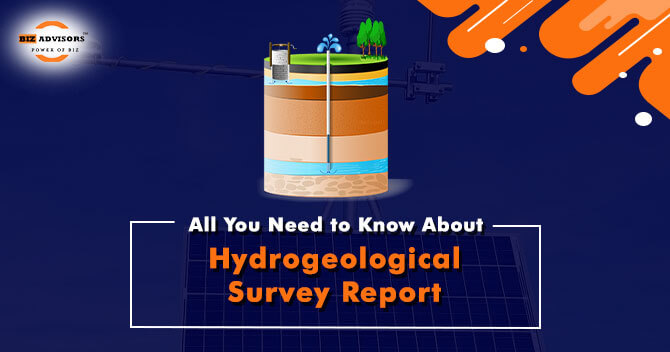
Hydrogeological Survey Report
The diverse geological structures with notable lithological and chronological changes, the intricate tectonic framework, climatic variations, and various hydro chemical factors all contribute to the highly complex groundwater behavior in the Indian peninsula. The limits of the surface basin are not the only place where aquifer groups in alluvial/soft rocks exist. An investigation of the subsurface hydrologic and geologic parameters of a particular region is called a hydrogeological survey. Maps of hydrogeology can be made using the information collected during such an investigation. It involves both a study of the rock’s ability to filter water and its water-bearing levels. The natural capacity of rocks to hold or oppose water is also assessed. The intensity of the water flow through pores or fractures is noted, along with the pressure, category, and quality of the groundwater.
Significance of Hydrogeological Survey Report
A Hydrogeological Survey is carried out to ascertain the amount and quality of water present at a particular location to ascertain the underground water level, such as in the case of drilling a bore well.
The superiority of underground water over surface water as a supply of drinking water has long been acknowledged. This is a result of the following elements:
· The lower danger of pollution, particularly if it is far from sanitary activity.
· As water passes through sand and stone, groundwater is organically purified.
· As long as bore wells are covered, there is less chance of contamination.
· The ocean is always comfortable no matter the time of year.
· Water availability is more likely during the summer because the water sources are situated at a deeper elevation.
In the present scenario, where pure, unpolluted water is in short supply, groundwater is a sustainable option that could resolve a water crisis for particular regions. Nonetheless, it can be challenging to ascertain the quantity and quality of accessible groundwater at the required spot. Hydrogeological survey techniques can identify groundwater sources and forecast produce and water purity. The evaluation of the rocks’ subsurface stratum also makes it easier to compile vital data regarding groundwater’s potential future uses.
Therefore, a hydrogeological survey report is necessary to offer reliable suggestions for borehole drilling that will help obtain high-quality groundwater for human consumption.
Constituents of the Hydrogeological Survey Report
The Hydrogeological evaluation is typically either basic or thorough. A fundamental survey contains the following:
· Identifying the users’ end needs to determine the position and amount of groundwater.
· Evaluation of the purity of groundwater
· Analyzing the catchment region
· Recommendations for borehole building
· Risk evaluation for the environment or human wellbeing
· The amount of groundwater anticipated from the specified site
Groundwater exploration, geophysical evaluations, aquifer parameter evaluation, groundwater prediction, and groundwater regime tracking are some of the tasks assigned to CGWB for hydrogeological mapping. Through its study, CGWB has compiled an enormous database of data on aquifer parameters, underwater lithological and geophysical records, and water levels and quality. To identify the aquifer-wise region appropriate for groundwater recharge, development, and preservation, hydrogeological maps and groundwater[1] planning processes were created with the help of the database analysis.
Essential Documentation and information
The following details should be included in the Hydrogeological Survey Report:-
· The project’s objective and extent
· Recording of Data Collection
· Website Overview
· Geologic setting
· Environment hydrogeologic
· Features on the surface
· A seismic event
· Knowledge sources
· Figures
· Information tables
· Impact on the subsoil
· Gathering data outdoors
· Interpretation and study of data
· The procedures and results of scientific tests
· Predictions
· Results
· Suggestions
Structural Framework of the Hydrogeological Survey Report
A Hydrogeological Survey Report will contain different information based on the project, as was previously mentioned.
Independent hydrogeological works ought to be well-structured and contain most, if not all, of the following components:
· Page 1: The title
· Page 2: The signature
· Table of Contents shows the tables, figures, and appendices
· Introduction
· The Function and Description of Hydrogeologic Systems
· Methods for Gathering Data
· Groundwater Use and Development Analysis Procedures and Methods
· Analysis of the hydrogeology
· Numerical model documentation (if modeling is performed)
· Findings regarding Water Quality Recommendations, if necessary
· Limitations on Reports
· Informational resources and references
· Statistics, illustrations, and appendices
Conclusion
The aforementioned text imparts an unambiguous picture concerning the Hydrogeological Survey Report. Hydrogeological Survey Report provides instantaneous support in framing the regulations which tend to govern groundwater functioning. It delineates a smooth and efficient pattern of groundwater operational management and substantially lays out policies for restoring the vitality of groundwater resources. The primary objective of the Hydrogeological Survey Report is to enlist variegated provisions in the context of underlining the problems concerning the efficient regulation of groundwater management. Our legal luminaries at BizAdvisors.io tend to provide a robust support system in the context of assisting individuals to easily obtain an ideal structural pattern of the Hydrogeological Survey Report. You can freely contact our legal consultants at BizAdvisors.io for any kind of professional assistance or support in the context of the structural framework of the Hydrogeological Survey Report.
Read our article:Everything You Need to Know About CGWA Water Boring